
By Bill Burke
Lake Erie and Lake Chautauqua are separated by a ridge of land known as the Chautauqua Ridge. Lake Erie is connected to the vast inland water routes that lead into the heart of North America and the Atlantic Ocean. Lake Chautauqua drains into the Allegheny River, which flows into the Ohio River and, eventually, the Mississippi River down to the Pacific through the Gulf of Mexico. Lake Erie is approximately 700 feet above sea level; the continental crest on this portage route between the St. Lawrence and Mississippi drainage basins is approximately 1500 feet above sea level.
The Chautauqua Portage, which stretches from Mayville on the shore of Lake Chautauqua to Barcelona on Lake Erie, has been used for centuries by Native Americans and early European settlers.
The Old Portage Road bridged the nine-mile land gap between the two lakes, allowing early travelers to move between these water systems. This was especially valuable in an era when rivers and lakes were the primary means of transportation, both for indigenous people and for European settlers.
Long before European colonization, the indigenous peoples of the region, including the Seneca, part of the Iroquois Confederacy, used the Old Portage Road as a key part of their trading networks. The road allowed for the transportation of goods such as furs, tools, and foodstuffs between their villages and neighboring tribes. The Seneca had an intimate knowledge of the land and waterways, and their use of the road as a portage between Lake Erie and Lake Chautauqua underscores its significance in pre-colonial North America.
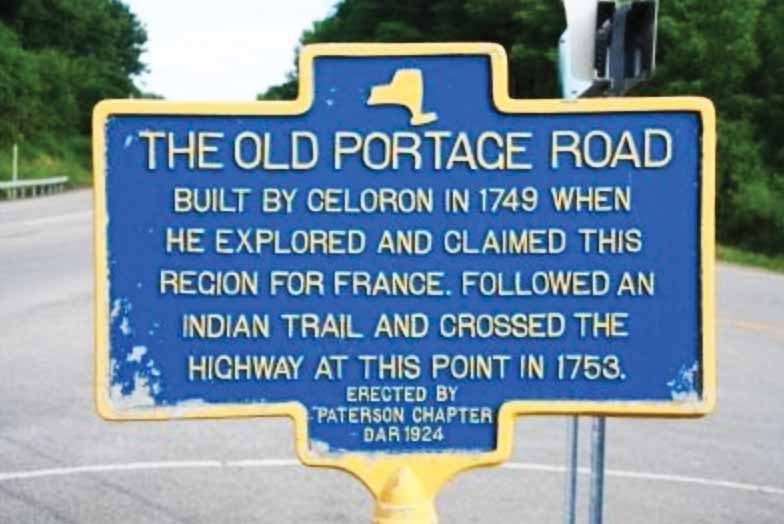
In 1615 Étienne Brûlé was the first to record usage of the trail by use the trail by a European. In 1749, an expedition under the command of Celeron de Bienville landed at the mouth of Chautauqua Creek on Lake Erie with the intent of claiming the Ohio Valley for the French. They hacked out a road to Chautauqua Lake through the forests that lined the trail on their way to the Allegheny River and eventually to the Ohio River.
In 1753, an expedition of 1,000 men converted the wagon road into a military road, used to supply men and materiel to the series of fortifications built by the French along the Allegheny River – Fort Le Boeuf, Fort Machault, and Fort Duquesne.
The British briefly re-established the trail in 1782, during the latter stages of the American Revolutionary War when they used Chautauqua Lake as a staging area to assail Fort Pitt, then held by colonials.
The strategic value of this route was not lost on the Europeans when they arrived. It became a point of contact—and often conflict—between European powers and Native Americans during the French and Indian War (1754–1763), as both sides vied for control over this vital region.
During both the French and Indian War and the American Revolution, the Old Portage Road served as a strategic route for military campaigns. Control of the region often shifted depending on which power could secure this transportation corridor. During the War of 1812, the road once again became strategically significant as American forces used it to move troops and supplies between Lake Erie and the western front. It was especially important in the Battle of Lake Erie, transporting supplies and canons to the US Navy in Barcelona Harbor, allowing them tio defeat the British fleet at Put-In-Bay, Ohio.
The road had strategic importance in the 18th and early 19th centuries as a vital artery for the movement of goods and people between the Atlantic Seaboard and the interior regions of North America. Today the roadway itself is still used for those traveling between Mayville and Westfield. Although it does deviate from the original trail, it is located nearby.
Historical marker on NY 394 east of Westfield commemorating the Old Portage Road.
Hand drawn illustration of the French Portage Road, c. 1912.
Remnants of the portage road remain to this day: most of NY 394 between the two waterbodies is named Portage Street, and a loop road off NY 394 south of the village of Westfield is called Old Portage Road. The loop road follows the original crossing of Little Chautauqua Creek, and ends at an abandoned closed-spandrel arch bridge.